History of Winshields Wall
The Romans built Hadrian’s Wall from AD 122 to define the northern boundary of the province of Britannia and the north-west boundary of their empire. Winshields Crags lies halfway along the Wall, where it ascends to its highest point, affording spectacular panoramic views.
Two short stretches of the Wall have been conserved on the crags and the locations of two milecastles and three turrets are known.
The design of Hadrian’s Wall
The original design for Hadrian’s Wall comprised a continuous wall, about 4.5 metres high, with a deep V-shaped ditch on its northern side, stretching for 80 Roman miles (117.5km) from Wallsend on the river Tyne in the east to Burgh-by-Sands on the Solway Firth in the west.
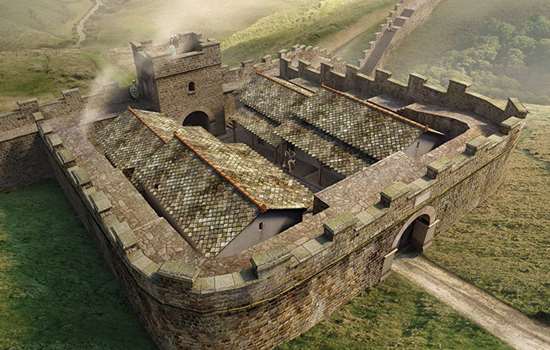
The Roman military builders incorporated about 160 watchtowers (known today as turrets) along it, providing vantage points to monitor movements of people, especially to the north. Pairs of turrets were spaced equidistantly between small forts, now known as milecastles, where garrisons of between 8 and 30 soldiers guarded gates that allowed access through the Wall.
After building had begun, the Roman authorities decided to incorporate large forts, such as Chesters, Housesteads and Birdoswald, into the line of the Wall. These housed larger forces of about 500 or 1,000 soldiers in each.
This imagined view looking south-east shows Hadrian’s Wall on Winshields Crags in the mid 2nd century AD, shortly after the Wall’s completion. The view reveals the strong position of the Wall on top of the crags of the Great Whin Sill. At the centre is turret 40a, in the highest location of all the turrets on Hadrian’s Wall
© Historic England/English Heritage Trust (illustration by Peter Urmston)
The Wall at Winshields
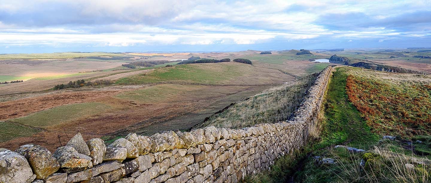
The Winshields section of Hadrian’s Wall stretches for 1.6 miles (2.6km) between Peel Gap in the east and Caw Gap in the west, crossing high, difficult country halfway along the Wall. The summit marks the Wall’s highest point, at 345 metres above sea level.
The Wall at Winshields generally survives as a low stony mound with a relatively recent field wall overlying it. However, there are two stretches where the Wall has been revealed and consolidated, surviving up to 2.44 metres wide and a maximum height of 1.7 metres. One of these, immediately east of the summit, is 60 metres long, and the other on the western descent is 300 metres long. These stretches were conserved in 1938–40, after the Winshields sector as a whole was given statutory protection in 1937, and again in 1956.
The steep crags of Winshields made a ditch north of the Wall here unnecessary. On the lower ground, however, good sections of ditch remain, notably for about 500 metres west from Peel Gap to the site of milecastle 40, where it remains up to 2.7 metres deep. Another good section covers a deep cleft in the crags at Lodhams Slack, just west of Winshields summit.
The sites of two milecastles, nos 40 and 41, can be identified as disturbed grass-covered stony banks covering their foundations, but no masonry remains are visible. Although the locations of three turrets are known on Winshields (nos 39b, 40a and 40b), there are no visible traces.
A conserved section of Hadrian’s Wall ascending Winshields, looking west towards the summit
The Wall nearby
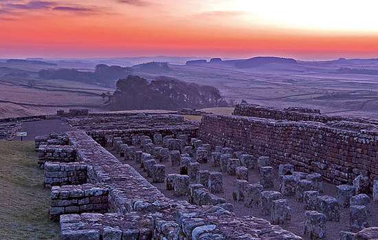
At Winshields you can enjoy a breathtaking walk to the highest point on Hadrian’s Wall, before continuing to the impressive Roman milecastle at Cawfields, 1.75 miles west. Just under 3.5 miles east of Winshields summit is Housesteads Roman Fort, Britain’s most complete Roman fort.
By Paul Pattison
Find out more
-
Hadrian’s Wall: History and Stories
Discover the history and stories associated with Hadrian’s Wall, the north-western frontier of the Roman Empire.
-

Emperor Hadrian
Emperor Hadrian focused on securing the empire’s existing borders, and Hadrian’s Wall was the most impressive statement of this policy.
-
EXPLORE ROMAN BRITAIN
Browse our articles on the Romans to discover the impact and legacy of the Roman era on Britain’s landscape, buildings, life and culture.
-
Buy the guidebook to Hadrian’s Wall
The English Heritage guidebook to the Wall provides maps, plans and tours of all the key sites, as well as a history of the Wall and its forts.